How Drone Technology Is Transforming Construction in 2026
The four pillars of drone benefits — efficiency, cost reduction, safety, and data accuracy — that progressive Kamloops contractors are leveraging to lead the market.
✅ What You'll Learn
- How drones deliver 75-90% faster surveys with centimeter-level accuracy
- The ROI reality: Most companies see full return within 3-6 months
- Safety improvements that can prevent $40,000+ accidents
- Real-world applications in residential, commercial, infrastructure, and mining projects
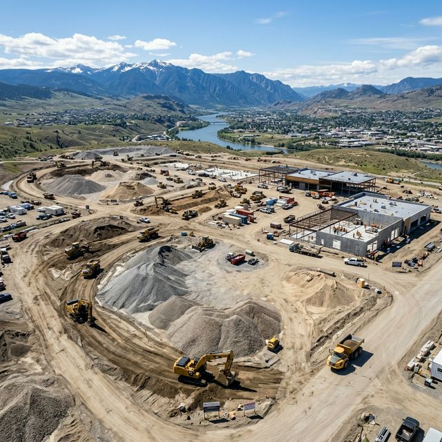
Commercial drones like the DJI Matrice 300 RTK deliver high-resolution imagery and LiDAR point clouds with centimeter-level accuracy, transforming construction workflows.
In 2026, drones are no longer "emerging tech" — they're standard practice on progressive job sites across British Columbia. Contractors who adopt drone technology now will lead their markets in 2030.
The Four Pillars of Drone Benefits
1. Efficiency: From Days to Hours
A drone captures complete site coverage in 30-90 minutes. High-resolution imagery and LiDAR point clouds are processed automatically, delivering same-day or next-day.
2. Cost Reduction: The Bottom Line Impact
Direct Savings
- Labor costs: Automated surveys reduce field crew time by up to 80%
- Equipment rental: No need for expensive surveying equipment or scaffolding
- Travel expenses: One pilot covers multiple sites in a day
- Rework prevention: Accurate data catches issues before they become costly mistakes
Indirect Savings
- Reduced insurance premiums from safer sites
- Fewer change orders from precise documentation
- Better material ordering from cut/fill calculations
- Faster project closeout from complete documentation
Most companies see full ROI within 3-6 months. Annual savings: $25,000-$100,000+.
3. Safety: Protecting Your Workforce
Drones handle dangerous tasks without human exposure:
- Roof inspections — no climbing required
- Tall structures — inspect chimneys, towers, facades from safe distances
- Steep slopes — map unstable terrain without sending personnel
- Active work areas — capture data without interfering with operations
- Confined spaces — access tight areas humans shouldn't enter
OSHA: $40,000-$50,000 per incident in direct costs. Preventing even one serious injury through drone use can pay for years of survey services.
4. Data Accuracy: Making Better Decisions
Modern commercial drones with RTK positioning achieve centimeter-level accuracy. What you actually get:
- Topographic surveys (contour lines, elevation points)
- Volumetric analysis (stockpile measurements ±1-2%)
- Cut/fill calculations for grading plans
- 3D site models (orthomosaics and DSMs)
- As-built documentation for design verification
- Progress tracking with side-by-side comparisons
Real-World Applications in Kamloops & TNRD
Residential
Pre-construction surveys, progress documentation, lot tracking, and final inspections — verify grading, drainage, and compliance before closeout.
Commercial
Site planning, structural inspections, safety audits, and marketing materials. Drone photography for leasing and sales that differentiates your project.
Infrastructure
Road construction monitoring, utility project mapping, bridge inspections, and floodplain monitoring for erosion and sediment control.
Mining & Aggregates
Stockpile management, reclamation planning, safety surveys mapping highwalls, and production reporting with accurate volumes for customer invoices.
Photogrammetry vs. LiDAR
| Feature | Photogrammetry | LiDAR |
|---|---|---|
| Uses | Overlapping photos → 3D models | Laser pulses → distance measurement |
| Best for | General surveys, progress, marketing | Forested sites, low-light, ultra-precision |
| Cost | Lower | 3-5× more expensive |
| Accuracy | cm-level | cm-level |
Leading Hardware in 2026
Getting Started
Define Your Use Cases
Identify 2-3 specific problems: better stockpile measurements, faster roof inspections, regular progress photos, or reducing rework from inaccurate surveys.
Consider Your Options
DIY: Purchase equipment, train, manage regulations. Outsource: Pay per project, no overhead. Hybrid: Basic drone in-house, complex work outsourced. For most Kamloops contractors, outsourcing provides the best balance.
Choose the Right Partner
Look for: local BC expertise, Transport Canada certifications, a relevant portfolio, clear deliverables, and turnaround time that meets your timeline.
Common Myths Debunked
Myth: "Drones aren't accurate enough"
Reality: Modern RTK drones match traditional survey accuracy with better coverage and faster delivery.
Myth: "It's too expensive for small contractors"
Reality: Outsourcing drone services costs far less than hiring dedicated staff. Many firms see ROI on their very first project.
Myth: "Weather will ground us constantly"
Reality: Drones operate in light rain, wind up to 30 km/h, and various lighting conditions. BC's overcast weather actually provides consistent lighting — better for imagery.
Myth: "Regulations make this impractical"
Reality: Transport Canada has streamlined commercial regulations. Licensed operators handle all compliance — so you don't have to worry.
The Future: Emerging Trends
Early adopters gain competitive advantages: faster delivery, higher quality, better client communication. The firms that integrate drones now will lead their markets in 2030.