Drone Services in Kamloops, the BC Interior and the Lower Mainland
Aerial media and site intelligence built for real estate sales and project reporting
From listing photography and 3D tours to construction progress tracking and survey-grade mapping, we deliver clear visuals and reliable data that help teams make faster, smarter decisions.
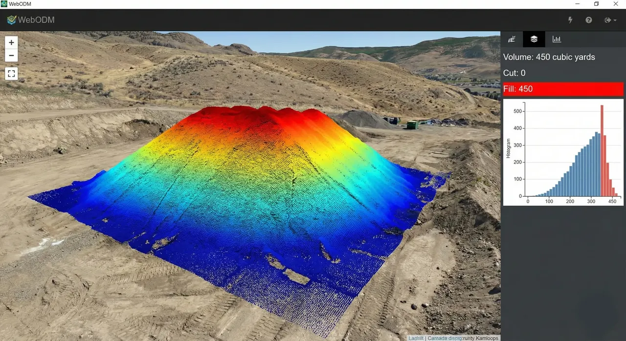
Volumetric Measurements & Data Capture
Precise stockpile volume calculations and aerial data capture for inventory management.
Our advanced photogrammetry provides accurate data for cut/fill analysis, material tracking, and inventory management. Perfect for construction sites, mining operations, and agricultural planning. Manage costs and timelines with confidence using our precise measurements.
What You'll Get
- Accurate stockpile volume calculations
- Cut/fill analysis for earthwork projects
- Inventory management and tracking
- Material volume reports
Starting at
$250+Commercial Videos & Photography
Brand-quality aerial videos and photography that tell your story from a unique angle.
Get professional-grade aerial content for marketing, social media, and promotional campaigns. From YouTube thumbnails to full production videos, our cinematic drone footage adds impact and perspective to your visual storytelling. Perfect for real estate listings, business promotions, and event coverage.
What You'll Get
- Cinematic aerial video production
- High-resolution aerial photography
- Social media ready content
- Marketing and promotional videos
Starting at
$249+Construction Progress & Terrain Scanning
Document every stage of your construction project with precision orthomosaics.
Our automated flight paths capture comprehensive site documentation for progress reporting and stakeholder updates. Generate high-resolution orthomosaics, 3D models, and topographic surveys that track your project from foundation to completion. Perfect for general contractors, project managers, and stakeholders.
What You'll Get
- Bi-weekly automated progress monitoring
- High-resolution orthomosaic maps
- 3D construction site models
- Stakeholder progress reports
Starting at
$299+Real Estate Photography & Virtual Tours
Complete interior and exterior property photography with drone and twilight conversion. 360 virtual tours for MLS listings.
Professional real estate photography services in Kamloops, BC. We provide complete interior and exterior property photography using drones and ground-based techniques. Includes twilight conversion for cinematic evening shots. Our Zillow-style virtual tours include floorplan navigation, hotspots, and WASD controls for an engaging buyer experience.
What You'll Get
- Complete interior and exterior property photography
- Drone-captured aerial imagery
- Twilight conversion for cinematic evening shots
- Interactive Zillow-style virtual tours with floorplan navigation
- 360-degree photo spheres optimized for MLS listings
Starting at
$150+Drone Surveying & Mapping
Professional survey-grade mapping services for construction and land development.
Our RPAS-certified pilots deliver accurate topographic surveys, boundary mapping, and site analysis. Generate contour maps, cross-sections, and volume calculations with centimeter-level accuracy. Perfect for engineers, surveyors, and developers who need reliable data for planning and permitting.
What You'll Get
- Survey-grade topographic mapping
- Contour line generation
- Boundary and site analysis
- Volume calculation reports
Starting at
$300+Tell us what you need, where it’s located, and when it needs to be done.
We’ll recommend the right service and provide a clear quote based on your project scope, timeline, and deliverables.